
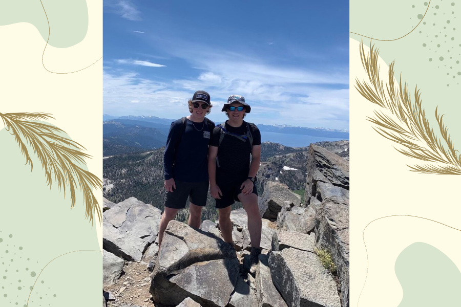

On the 1st of August, 2023 former Sartell High School student Connor Hacker and I hiked towards the peak of Mt. Rose, NV. Along the way we could see views of Lake Tahoe towards the west in the distance, as well as the entire basin holding Reno, Nevada. Overall the hike begins at 8,412 ft and peaks at 10,725 ft, giving an elevation gain of 2,313 ft. The entire hike covers a distance of 10.82 miles from the base to the peak and back. Connor and I began the hike at 9:30 AM.

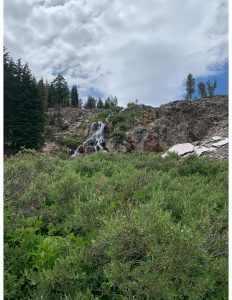
 The first 3 miles were along varying elevations up and down until we reached the bottom of a large basin with a waterfall and small creek running through the edge.
From here the trails split with one continuing on to the Lake Tahoe Trail which is a 165 mile hiking trail around Lake Tahoe and the surrounding area. The second trail leads to the peak of Mt. Rose starts with a small trail along the bottom of the basin. The basin was full of long grass and small creeks formed from Snow Runoff, however, once we reached the edge of the basin the elevation changed rapidly towards the peak. For the next 2 miles to the peak it was the hardest portion of the hike with the trail reaching 45 degree upward angles at some points. Towards the 9,500 ft mark the tree line gave way to a rocky landscape and beautiful views of the surrounding environment. Not long after breaking through the tree line the two of us reached the peak giving us an unrestricted view of Lake Tahoe, Reno, NV along with the Carson and Viginia Range mountains. From the peak it was another tough 5.4 miles back to the bottom in total taking us 4 hours to complete. What caused this hike to be so challenging was due to the rapid increase in elevation and thinning air as well as the rough rocky terrain towards the top of the Mountain. However, I would recommend not straying away from the challenge as the breathtaking views of Nevada and California make it all worth it.